All issues
Volume 123 (2014)
- Issue 6 Pages 789-
- Issue 5 Pages 643-
- Issue 4 Pages 389-
- Issue 3 Pages 323-
- Issue 2 Pages 159-
- Issue 1 Pages 1-
Volume 123, Issue 4
Special Issue on “Tokyo: Past, Present, and Future (Part III)”
Displaying 1-20 of 20 articles from this issue
- |<
- <
- 1
- >
- >|
Cover
-
2014 Volume 123 Issue 4 Pages Cover04_01
Published: August 25, 2014
Released on J-STAGE: September 01, 2014
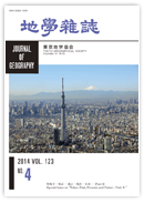
JOURNAL FREE ACCESSAs one of the biggest megacities in the world, Tokyo has a wide range of functions. As a result, many high-rise buildings are concentrated in certain districts as people try to use limited land resources efficiently. Tokyo Skytree (634 m in height) also plays an important role on Tokyo’s skyline now. The tower was completed and opened to the public in May 2012. Since then, it has become a symbolic landmark of Tokyo. We forecast that these artificial landscapes will continue to change through a process of progressive redevelopment. However, Mt. Fuji (UNESCO World Heritage site) will remain an indispensable and unchangeable element of Tokyo’s landscape in the future.
(Photo courtesy: Tokyo Metropolitan Government; Explanation: Masaaki KUREHA)View full abstractDownload PDF (1271K)
Special Issue on “Tokyo: Past, Present, and Future (Part III)”
Special Contribution
-
Prince Naruhito2014 Volume 123 Issue 4 Pages 389-400
Published: August 25, 2014
Released on J-STAGE: September 01, 2014
JOURNAL FREE ACCESSDownload PDF (7380K)
Original Article
-
River Improvement Works in the Kanto Plain and Constraints of Tectonic SettingTomio INAZAKI, Yoko OTA, Shigenori MARUYAMA2014 Volume 123 Issue 4 Pages 401-433
Published: August 25, 2014
Released on J-STAGE: September 01, 2014
JOURNAL FREE ACCESSRiver improvement works in the Kanto Plain have long history of over 400 years. Rice-paddy development in the Kanto Plain was significantly delayed compared to that in other plains including the Osaka Plain and the Nobi Plain. This was because of the difficulty in constructing an irrigation and drainage network, and protecting rice paddies from inundation. Therefore, the Tokugawa government started river improvement works in the Kanto Plain just after Tokugawa settled in Edo in 1590, and the works continue now. The flow of the Tone River into Tokyo Bay was originally blocked by uplands, but was finally rerouted to Choshi, 90 km east to the original mouth. The Ara River was also rerouted to the south. The purpose of rerouting was not only to reduce the risk of flooding in Edo city, but also to develop a waterway network for rice paddies to expand in the central Plain. Moreover, rerouting and connecting the Tone River with the Edo River enhanced the inland waterway transportation network of the Kanto Plain. Accordingly, a number of riverside towns, or Kashi, grew as nodes of the network. Small sailing ships and flatboats were the major conveyors of products. During the Meiji era, which followed the Edo period, canals were constructed and steamboats were introduced to replace sailing ships, at a time when water transportation was peaking. The inland waterway soon began to be replaced by present-day economic transportation systems such as rail and road.
The central Kanto Plain was featured consistently by a subsiding basin through the Quaternary. Although the entire Plain was uplifted, Tokyo Bay, at the center of the Kanto Plain, sank over 1000 m. In contrast, the outer margin of the plain was uplifted 50 to 1000 m. Choshi, at the mouth of the present Tone River, is in the uplifted area. In contrast, the lower reaches of the River are at the northern extent of the subsiding basin. This is the reason why back swamp lakes or an estuary such as Kasumiga-ura and the ancient Katori-no-umi were formed in the area.
Such crustal movements in the Kanto Plain continued throughout the Quaternary. Hydration and dehydration of two plates lying beneath this region were the driving force. Hydration of mantle peridotite underneath the Kanto Plain due to dehydration of the underlying Philippine Sea Plate (PHS plate), subducting from south to north 30-60 km deep (2 cm/year), causes volumetric expansion particularly at the marginal zone of the overlying plate (North American (NA) Plate). Serpentinized peridotite, produced above the Pacific Plate (PAC plate), which subducts from east to west under the PHS and NA plates, expands like popcorn and results in uplifting of the Boso Peninsular (non-volcanic outer arc) . In contrast, the sinking of the Tokyo Bay area is explained by the overlapping of the fore arc basin towards the PHS and PAC plates. From the viewpoint of tectonics, the sinking belt including Tokyo Bay is in a physical field where a sedimentary basin formed under tensile stress in the NE-SW direction. Small mantle convection caused by serpentinization of the uppermost mantle beneath the fore arc is the key to understanding the tectonic setting of the Kanto Plain.View full abstractDownload PDF (8242K) -
Takashi FURUMURA2014 Volume 123 Issue 4 Pages 434-450
Published: August 25, 2014
Released on J-STAGE: September 01, 2014
JOURNAL FREE ACCESSIn the Kanto basin, long-period (T = 6-8s) ground motions develop during large (M > 7) earthquakes due to the resonance of surface waves with thick (> 3000m) sedimentary layers covering rigid bedrock. Such long-period ground motions can cause significant damage to modern large-scale, long natural-period structures such as skyscrapers, oil storage tanks, and long bridges. Therefore, it is important that residents of modern Tokyo metropolitan area cities be forewarned about the potential for such disasters. In the present paper, the development of large and long-duration, long-period ground motions in central Tokyo is investigated by analyzing waveform data from recent large earthquakes obtained from dense seismic networks extending over the Kanto basin. It is demonstrated that the interaction of surface waves with the three-dimensional sedimentary structure beneath the Kanto region causes peculiar and directional dependencies related to the amplification strength of the long-period ground motions. For example, the long-period ground motions resulting from earthquakes occurring in northern Japan cannot develop efficiently in central Tokyo. This might be one reason for the relatively weak long-period ground motions observed in central Tokyo during the 2011 Off Tohoku M 9.0 earthquake compared to those of other M 7-8 class events, such as the 1944 Tonankai (M 7.9) and the 2003 Off Tokachi (M 8.0) earthquakes. The results of computer simulations using detailed subsurface structures and source-slip models for an anticipated Nankai Trough M 8.7 earthquake indicates that the strength of long-period ground motions in central Tokyo can be expected to be at least double than those observed during the 2011 Off Tohoku earthquake.View full abstractDownload PDF (8177K)
Review Article
-
Keisuke MATSUI2014 Volume 123 Issue 4 Pages 451-471
Published: August 25, 2014
Released on J-STAGE: September 01, 2014
JOURNAL FREE ACCESSThe distribution and landscape of temples and shrines and their functions in the City of Edo are examined, and urban structures constructed based on mystical and religious aspects of spatial design are evaluated.
The five key findings of this study are:
1. A city design modeled on Heiankyou (ancient Kyoto) was applied to the construction of the City of Edo, and was arranged according to four directions and their connections with gods. This model was meant to protect the City of Edo not only militarily, but also in magical and religious ways. In particular, large temples and chinju-sha shrines, which were strongly associated with the Tokugawa shogunate family, were placed to face northeast/southwest—directions regarded as being unlucky—as well as towards places of execution and the locations of red-light districts in areas bordering the city. This placement created an extraordinary atmosphere in the city. Tokugawa Ieyasu was awarded a posthumous shingo (literally, a Shinto deity) title, “Tosho Daigongen,” and was enshrined angled towards the North Star (i.e. Nikko) to protect the City of Edo. The attempt to harness these magical factors to protect and safeguard the City of Edo is one of its characteristics.
2. Temples and shrines were under the control of the Tokugawa shogunate during the Edo Period, and the Honmatsu-seido (government-enforced main-branch temple system) was established through the enactment of jiinhatto (laws for temples). In addition, members of the public were forcibly linked to temples and shrines through their status as danka (temple supporters) under the Terauke seido (a system that compelled the public to become Buddhists). Through this administration of religion, temples were integrated into a system for maintaining social order as a marginal role in the mechanism of the Tokugawa shogunate.
3. The temple and shrine estates as a whole were almost the same size as the space allocated for the townspeople, and occupied a large proportion of the City of Edo in terms of land use. Shrines increased rapidly in number as the city's population increased. As a result, control measures were introduced to restrict the establishment of temples in the city's central area, where strong demand had led to a severe land shortage, and these temples were instead almost forcibly moved to the suburbs. This tendency became more evident in city planning after the Great Fire of Meireki in 1657; subsequently, new “towns of temples” were created in districts such as Asakusa, Shitata, and Mita.
4. The rapid expansion of urban areas in the City of Edo led to religious facilities using their precincts as places to lease land and rent houses. As a result, new monzen-machi (temple towns) were created within the precincts of large temples, and some of these towns developed into entertainment districts, housing performing arts and drama facilities.
(View PDF for the rest of the abstract.)View full abstractDownload PDF (4242K) -
Mayumi YOSHIOKA2014 Volume 123 Issue 4 Pages 472-485
Published: August 25, 2014
Released on J-STAGE: September 01, 2014
JOURNAL FREE ACCESSBesides the immediate need for alternative sources of energy, it has become increasingly crucial to maximize the use of the limited energy sources that remain after the Great East Japan Earthquake. Tokyo, which consumes an enormous amount of energy, should lead this effort by exploring ways of becoming an advanced energy-saving city in the future. This paper focuses on the thermal energy of water, which is one of the available energy sources in Tokyo. The potential of the thermal energy of water could be harnessed to improve the thermal environment and reduce energy use in Tokyo. One way to use this energy is to harness the heat of evaporation by sprinkling water on a pavement in order to improve the thermal environment in summer in cities where the heat island phenomenon is observed. This technique of sprinkling water is known to the Japanese as Uchimizu, and it is a time-honored custom in Japan. Some studies involving field experiments and numerical simulation have investigated the cooling effect of sprinkling water scientifically by applying systematic sprinkling as a countermeasure for the formation of heat islands. The other way of employing this source of energy is to use a ground-source heat pump system, which is a high-performance cooling and heating system, using subsurface and groundwater thermal energy efficiently. Active use of thermal energy of water is considered to be one strategy that Tokyo can adopt to become an energy-saving and environmentally friendly city in the future.View full abstractDownload PDF (1650K)
Original Article
-
Kazunari KAINOU2014 Volume 123 Issue 4 Pages 486-496
Published: August 25, 2014
Released on J-STAGE: September 01, 2014
JOURNAL FREE ACCESSThis paper discusses sustainable long-term energy demand and supply in the Tokyo Metropolis. The current demand and supply for energy in Japan does not fulfill the conditions for continuous sustainability, whereby the entire primary energy supply is covered by renewable energy, due to high dependency on oil imports during and after the period of rapid economic growth from the 1950s to the 1970s. Consequently, Japan's energy policy since 1990 has sought transitional sustainability, which improves energy efficiency at the demand side and diversifies energy sources and promotes renewable energy at the supply side to achieve continuous sustainability in the future. However, in the Tokyo Metropolis, where population density and integration of commercial and service sectors is high, it is difficult to achieve even transitional sustainability compared to other prefectures. Therefore, possible ways to achieve transitional sustainability in the Tokyo metropolis are discussed using long-term and regional energy statistics.View full abstractDownload PDF (2141K)
Review Article
-
Shinya NUMATA2014 Volume 123 Issue 4 Pages 497-515
Published: August 25, 2014
Released on J-STAGE: September 01, 2014
JOURNAL FREE ACCESSTokyo, the capital of Japan is one of the largest cities of the world. The administrative area of the Tokyo Metropolitan government covers the 23 special wards of Tokyo to the east, 26 cities to the west (Tama) and two outlying island chains (Izu and Bonin). Despite Tokyo being relatively small in area, it has a rich biodiversity that requires conservation efforts. I review the current status of the natural environment and biota (especially, flora of vascular plants and mammalian fauna) and discuss perspectives of biodiversity in Tokyo. There are different types of ecosystems in Tokyo: urban, secondary forest and agriculture (Satoyama), and oceanic island ecosystems. Different types of landscape support different habitat specialists. In Tokyo, the total numbers of wild plant and mammal species were estimated to be 4323 and 51, respectively. On the Izu and Bonin islands, species richness is relatively low, but endemism is high. The four principal pressures directly driving biodiversity loss (habitat change, abandonment of agricultural landscape management, pollution and invasive alien species, and climate change) are either constant or increasing in intensity in Tokyo. Although nature conservation has had significant results in maintaining biodiversity in urban and agricultural landscapes, there may be an emerging problem of human wildlife conflict in urban area due to biodiversity conservation projects in Tokyo. On the oceanic islands of Tokyo, alien species still seriously threaten endemic species of some taxa despite eradiation efforts. In 2010, Japan hosted COP-10 to the Convention of Biological Diversity (CBD). The results of COP-10 have had great impacts on policy and practices for conserving and managing biodiversity in Japan. Considering nature to be mostly anthropogenically-influenced in Tokyo, promoting a public understanding of biodiversity is the key to drawing up an urban planning framework for the sustainable management of biodiversity.View full abstractDownload PDF (1919K) -
Toshimitsu DOI2014 Volume 123 Issue 4 Pages 516-527
Published: August 25, 2014
Released on J-STAGE: September 01, 2014
JOURNAL FREE ACCESSEco-City is a term used in national policy. I define terms related to environment policies such as Eco-City, Eco-police, and Compact-City. The Eco-City concept is evaluated in an attempt to integrate several environment measures into an environmental policy intended for a certain area in a city. Because environmental policies cover a wide area, we need common criteria for all environmental measures. I examine an environmental policy criterion in order to achieve an Eco-city. As a result, I propose reducing energy consumption, and point out the importance of transparency in energy control. Because it is important that we are not indifferent to environmental problems, when implementing environmental measures, we have to make good use of the resources in Tokyo such as neighborhood associations, parks, agricultural land and a public transportation network.View full abstractDownload PDF (798K) -
Takashi TODOKORO2014 Volume 123 Issue 4 Pages 528-541
Published: August 25, 2014
Released on J-STAGE: September 01, 2014
JOURNAL FREE ACCESSTokyo has accumulated more than half of Japan's key controlling functions in a information-oriented society. Consequently, the disadvantages of accumulation have outweighed its advantages. If a massive earthquake hit the capital city, the politico-economic nerve center of Japan would collapse and it could trigger off politico-economic instability in the world. Tokyo's capital functions should be decentralized in order to prevent such global adversity from happening.
Decentralizing the capital functions would be effective in promoting overall political reforms, rectifying overconcentration of key functions in Tokyo and improving nation's emergency response capabilities to disasters. Once the decentralization were implemented, Tokyo could rediscover its unique potentialities based on newly developed concepts, which would lead to creating a brighter future for “Tokyo as a world city.”
The location of the Central Gunma is ideal for the decentralization of Tokyo's capital functions. Conveniently located at about 100 km from Tokyo, the area could closely cooperate with Tokyo. Moreover, fewer natural disasters have had hit the area, which means that it could accommodate bases serving as backups for Tokyo's essential systems. In addition, the Central Gunma is located in a commanding position to oversee both the Pacific Rim Economic Region and the Japan Sea Rim Economic Region.View full abstractDownload PDF (1006K)
Original Article
-
Tetsuo SHIMIZU2014 Volume 123 Issue 4 Pages 542-555
Published: August 25, 2014
Released on J-STAGE: September 01, 2014
JOURNAL FREE ACCESSThis paper explains the history of transport system development, travel and freight demand characteristics, and future transport planning issues in the Tokyo Metropolitan Region. The daily number of trips is 2.45 according to the 5th Tokyo Person Trip Survey carried out in 2008, and this has not changed in the last two decades. During the last decade, the modal share of railways increased, while that of private cars decreased. A total of 2.3 million tons of freight were transported in the Tokyo Metropolitan Region based on the 2003 Freight Flow Survey. The unique characteristics of the urban railway system of the Tokyo Metropolitan Region are that many private companies have constructed and operated networks, and that through operations among several routes has been widely introduced. Besides, the Tokyo Metropolitan Expressway is a unique infrastructure. Conversely, airport and seaport systems in Tokyo have fewer unique features and are less competitive than other major airport and port systems in Easten Asia Region. Basic transport infrastructures of roads, railways, airports and seaports in the Tokyo Metropolitan Region have almost been completed due to a series of intensive transport infrastructure plans whose objectives were to assist economic growth. The basic direction of transport planning in the Tokyo Metropolitan Region over the coming decades will be an improved management system to better utilize current transport infrastructures. Some planning issues are highlighted based on future socio-economic perspectives of the region.View full abstractDownload PDF (1338K) -
Hideaki KURISHIMA2014 Volume 123 Issue 4 Pages 556-574
Published: August 25, 2014
Released on J-STAGE: September 01, 2014
JOURNAL FREE ACCESSWaste is an unavoidable problem when discussing an urban space. To understand the urban space of Tokyo, it is important to understand how Tokyo has addressed the waste problem. This paper examines actual conditions and future prospects for the managing Municipal Solid Waste (MSW), dividing Tokyo into the special wards area and the Tama area.
In the special wards area, the Tokyo metropolitan government constructed waste incineration facilities based on the district self-sufficiency principle (disposing of your own waste in your own ward), which were established by the so-colled Tokyo garbage war in the 1970s. However, management of MSW in the Tokyo special wards area changed greatly after responsibility for MSW shifted to the wards in 2000. First, the district self-sufficiency principle was abandoned. Second, differences in separating and recycling waste among wards occurred. Third, plastic waste was incinerated. In the future, at the waste collection stage, the door-to-door method is expected to spread among wards. Moreover, at the incineration disposal stage, although the district self-sufficiency principle was abandoned, fairness is expected to be maintained among the wards using economic instruments and considerations to ensure a regional balance. It seems that the final disposal sites will be able to take in waste for the next few decades by reducing waste generation, and carrying out ash melting and plastic incineration.
In the Tama area, municipalities established waste management systems that aimed to dispose of waste appropriately against the background of urbanization in the 1960s. Solid waste from dustboxes was incinerated in communal incinerators. Incinerated ash was filled in the final disposal site in Hinode town. However, municipalities were compelled to shift to a form of management that reduces waste as remaining final disposal sites were decreased significantly, and problems concerning sites with neighboring residents occurred in the 1990s. Therefore, some local municipalities such as Hino city in the Tama region made changes to their waste management systems, and succeeded in reducing waste for disposal. According to the results of a questionnaire given to residents of Hino city, the biggest factors of waste reduction were introducing a charge for waste collection and a door-to-door collection system. In the future, the management aimed at reducing waste will be maintained in the Tama region. In addition, the reduction of remaining final disposal sites has been slowed down by changing waste management and operating eco-cement facilities.View full abstractDownload PDF (2718K) -
Toshio KIKUCHI, Ryo IIZUKA2014 Volume 123 Issue 4 Pages 575-586
Published: August 25, 2014
Released on J-STAGE: September 01, 2014
JOURNAL FREE ACCESSFood-supply infrastructures in the metropolitan and urban fringe areas of Japan have weakened in recent decades. Consequently, it will be important in the future to optimize supply and demand when managing food in Tokyo. The Tokyo market has taken a variety of measures to solve inevitable problems. In a historical context, the development of suburban agriculture and transport infrastructure for supplying food played important roles in balancing the supply and demand of food in Edo—what is now Tokyo. When demand expands, food shortage problems arise, which are solved by improving the infrastructure of production and supply. In the Tokyo market, food was supplied from many domestic producing areas, with the food-supply area expanding in the latter half of the twentieth century. At the same time, food supplies were globalised by imports. As a result, in the Tokyo market, preferred foods were mass-produced in major and large producing areas, which were cheap and well regulated in terms of colour, form, and size, with reductions of food produced in minor and small producing areas. However, in the twenty-first century, alternative added value, which is not related to economic profits and efficiency, is being found in food production, supply, and consumption. Such added value derives not only from high quality and branding, but also from the safety, freshness, and traceability of food supplied.View full abstractDownload PDF (1108K) -
Hideki AZUMA2014 Volume 123 Issue 4 Pages 587-599
Published: August 25, 2014
Released on J-STAGE: September 01, 2014
JOURNAL FREE ACCESSUrban planning and big events, such as the Olympic Games and Universal Expositions, are complementary. Big events promote urban planning, and often cause it to evolve. Urban development by Napoleon III and successive Universal Expositions led Paris to become a fashionable global center. The 2012 Summer Olympic and Paralympic Games in London contributed to gentrifying the London Docklands and the neighboring East End. The 1964 Summer Olympic Games in Tokyo also led to modernization of urban infrastructures and celebrated Japan’s revitalization and progress after the Second World War. However, the 1964 Olympic Games left some bad legacies, including damage to the historical landscape around Nihon-bashi bridge by an expressway. Now, as we prepare to hold the 2020 Summer Olympic and Paralympic Games in Tokyo, we should think not only about the events but also urban planning at the Tokyo Waterfront, where the main facilities are to be built. This paper presents the relationship of between urban planning and big events in modern history, and discusses implications and possibilities.View full abstractDownload PDF (1736K) -
Yasushi AOYAMA2014 Volume 123 Issue 4 Pages 600-613
Published: August 25, 2014
Released on J-STAGE: September 01, 2014
JOURNAL FREE ACCESSThe range of Tokyo's big-city functions and activities roughly corresponds to an area of 100km in diameter circumscribed by the planned Ken-O (or Metropolitan Inter-City) Expressway. This basically defines the range of daily economic and social activity in the Tokyo metropolitan area. Tokyo's strength and appeal as a city lie in the way the entire megalopolis has come to function as one vast center of intellectual activity. Today, in response to the emergence of an advanced information society, office buildings are being transformed from places for performing routine administrative tasks to bases for the transmission and reception of information and centers for the kind of knowledge-intensive activity that generates wealth. In the advanced information age, the core function of the office building has evolved from mass-processing of paperwork and clerical tasks to the creation and exchange of knowledge. The amorphous and flexible system makes Tokyo's management both unique and practical. In Tokyo the role in support, development and mutual aid is largely performed by neighborhood associations and other local community organizations. The key characteristics of Tokyo's rail network are the large number of stations, the existence of two complete loop lines, and interline through service between subways and private rail lines. These features are the product of various measures developed during the period of rapid economic growth to make long-distance commuting as smooth as possible for massive numbers of commuters. As a result, Tokyo now has the most convenient rail network of any city in the world. When planning road traffic, the most rational approach is to add several restricted-access ring roads to a city's grid-pattern street plan, constructing them in such a way that they pass under or over other streets. Tokyo has such a plan. Tokyo can now boast a four-runway airport within 15 kilometers of the city center. Tokyo proposes to hold the Olympic Games not in the outer neighborhoods or the suburbs but right in the heart of the city. Cities evolve and the Olympics have a way of accelerating the process. The key is to ensure that evolution is not confined to any one city but contributes to the evolution of human society as a whole. Instead of being an industry-focused metropolis, Tokyo should aim to be a center for the arts, entertainment and sports. Tokyo should show the world a new model of a matured society, in which the quality of life is enhanced. The capital already leads other cities with facilities for elderly citizens and disabled people, but Tokyo still has room to improve as a barrier-free society.View full abstractDownload PDF (2032K)
Discussion
-
Toshio KIKUCHI, Tomio INAZAKI, Yohta KUMAKI, Masaaki KUREHA, Osam SANO ...2014 Volume 123 Issue 4 Pages 614-627
Published: August 25, 2014
Released on J-STAGE: September 01, 2014
JOURNAL FREE ACCESSDownload PDF (499K)
Overview
-
Toshio KIKUCHI, Tomio INAZAKI, Yohta KUMAKI, Masaaki KUREHA, Osam SANO ...2014 Volume 123 Issue 4 Pages 628-633
Published: August 25, 2014
Released on J-STAGE: September 01, 2014
JOURNAL FREE ACCESSDownload PDF (208K)
Afterword
-
Toshio KIKUCHI, Tomio INAZAKI, Yohta KUMAKI, Masaaki KUREHA, Osam SANO ...2014 Volume 123 Issue 4 Pages 634-641
Published: August 25, 2014
Released on J-STAGE: September 01, 2014
JOURNAL FREE ACCESS
Pictorials
-
Masaaki KUREHA2014 Volume 123 Issue 4 Pages xi
Published: August 25, 2014
Released on J-STAGE: September 01, 2014
JOURNAL FREE ACCESSDownload PDF (956K) -
Masaaki KUREHA2014 Volume 123 Issue 4 Pages xii
Published: August 25, 2014
Released on J-STAGE: September 01, 2014
JOURNAL FREE ACCESSDownload PDF (959K)
- |<
- <
- 1
- >
- >|