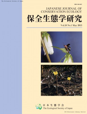
Japanese Journal of Conservation Ecology
Online ISSN : 2424-1431
Print ISSN : 1342-4327
Volume 18, Issue 1
Displaying 1-15 of 15 articles from this issue
Original Article
  • Tetsuroh Ishikawa, Mikumi Takada, Keishi Tokunaga, Katsunori Tachihara
    Article type: Original Article
    2013 Volume 18 Issue 1 Pages 5-18
    Published: May 30, 2013
    Released on J-STAGE: August 01, 2017
    JOURNAL OPEN ACCESS
    On Okinawa-jima Island, we collected 30 species and one hybrid of non-native freshwater fish during 1996-2011. Of these, 22 species native to various temperate and tropical regions were reproducing in the wild. The number of reproducing non-native fish was more than three times that of native fish (seven species). The main introduction pathway of non-native fish to Okinawa-jima Island was the release of ornamental pet fish. The distribution patterns of non-native fishes were classified into four categories: very wide (Oreochromis mossambicus and Poecilia reticulata), wide (four species, e.g., Gambusia affinis), intermediate (five species, e.g., Pterygoplichthys disjunctivus), and rare (20 species, e.g., Clarias batrachus). Positive relationships between the occurrence of non-native fish and human population density suggest that human activities and associated artificial environmental changes facilitate the invasion of non-native fish. The rate of range expansion varied across species. In particular, the range expansion of three species (e.g., Micropterus salmoides) that are classified as highly invasive in other regions was relatively slow, suggesting that the invasiveness of non-native fish depends on local environmental conditions. Establishing stricter rules regarding the release of ornamental fish is crucial for preventing new invasions on Okinawa-jima Island.
    Download PDF (1974K)
  • Junichi Imai, Taku Kadoya, Izumi Washitani
    Article type: Original Article
    2013 Volume 18 Issue 1 Pages 19-31
    Published: May 30, 2013
    Released on J-STAGE: August 01, 2017
    JOURNAL OPEN ACCESS
    Satoyama is a rural landscape consisting of a diverse mosaic of agricultural and nonagricultural land that provides suitable habitats not only for habitat specialists but also for multi-habitat dwellers. In the present study, we examined land-cover data at an appropriate combination of spatial scale and resolution, to calculate a land-cover heterogeneity index for the state of biodiversity in the Satoyama landscape. We used spatial distribution data of aquatic organisms typical of the Satoyama landscape in the examinations, which were obtained by participatory monitoring in Fukui prefecture. We calculated heterogeneity indices for 12 combinations of spatial unit sizes and land-cover resolutions: four different spatial unit sizes (2×2km^2, 5×5km^2, 6×6km^2, 10×10km^2) and three different land-cover resolutions (50m, 500m, 1000m), and analyzed the relationships between the indices and distributions of 21 aquatic species using Bayesian hierarchical models. The analysis revealed that the index calculated using a combination of 6×6km^2 spatial unit size and 50m resolution was the best for explaining the distribution of these species. Thirteen of the 21 species examined displayed a significant positive response to the index, suggesting that the index is useful for biodiversity assessments of the Satoyama landscape.
    Download PDF (1898K)
  • Takashi Shiga, Masashi Yokogawa, Shingo Kaneko, Yuji Isagi
    Article type: Original Article
    2013 Volume 18 Issue 1 Pages 33-44
    Published: May 30, 2013
    Released on J-STAGE: August 01, 2017
    JOURNAL OPEN ACCESS
    Nuphar submersa and N.×fluminalis (Nymphaeaceae) are critically endangered macrophytes found in central Japan, comprising only four populations each. In recent years, gathering for horticultural trade has damaged the remnant populations. We investigated the species and localities involved in trading plants of these species and Nuphar plants named "Nagaba-benikohone" based on morphological research and analysis of 15 microsatellite loci. We bought 10 plants from two garden stores. Our morphological research identified a plant named "N. submersa" sold by Store T (T1) as N. submersa and nine plants sold by Store C (C1-C9) as N.×fluminalis. In these 10 plants, two multi-locus genotypes were detected. Referring to the genotype data for N. ubmersa and N.×fluminalis, the genotype of T1 corresponded to NIK-25 (N. submersa), and the other nine plants (C1-C9) corresponded to SAN-10 (N.×fluminalis). The low genotype probability (GP) indicated that the traded plants and wild plants were the same genets and gathering had occurred in populations NIK and SAN. Since our preliminary genetic identification of trading in Nuphar was published, there have been no trades on the web sites. Genotype data based on all remnant individuals will be useful for assisting in preventing the gathering and trade of these plants.
    Download PDF (574K)
  • Kohei Kakehashi, Ryoichi B. Kuranishi, Naoto Kamata
    Article type: Original Article
    2013 Volume 18 Issue 1 Pages 45-54
    Published: May 30, 2013
    Released on J-STAGE: August 01, 2017
    JOURNAL OPEN ACCESS
    We performed a bait trap survey in a Japanese cedar plantation to determine the environmental factors affecting the spatial distribution and activity of terrestrial firefly larvae. First, using cumulative numbers of captured larvae, the spatial distribution pattern was estimated at three different scales. The most important environmental factors (soil temperature, soil moisture, undergrowth coverage, and solar insolation) were then determined using statistical model selection. Larval spatial distribution was aggregated at the 5 m scale and was positively affected by soil temperature and undergrowth coverage. Distribution was random at the 1 m scale and was negatively correlated to solar insolation. At the 50 cm scale, larval distribution was aggregated but not significantly correlated to any environmental factor. Second, activity was analyzed by selecting models incorporating the daily sum of captured larvae as the response variable and environmental conditions (soil temperature, soil moisture, and occurrence of rainfall on the previous night) as the explanatory variables. Soil moisture positively influenced the daily sum of captured larvae, and the random effect involved tended to increase from July (just after the ovipositional season) to May (season prior to pupation). According to the mosaic distribution of favorable habitat at the 5 m scale, even minor distruction of habitat can be threatening. We suggest that the efficiency of future larval spatial distribution surveys will be enhanced by lightly moistening the habitat.
    Download PDF (1197K)
  • Yusuke Miyazaki, Akira Terui, Akira Yoshioka, Kenzo Kaifu, Izumi Washi ...
    Article type: Original Article
    2013 Volume 18 Issue 1 Pages 55-68
    Published: May 30, 2013
    Released on J-STAGE: August 01, 2017
    JOURNAL OPEN ACCESS
    We investigated the ichthyofauna of 18 temporary lentic water bodies along the river (floodplain sites), as well as reference sites including two isolated ponds, two oligotrophic wetland sites dominated by sphagnums, and four lentic tributaries (non-floodplain sites) in the Shubuto River System, SW Hokkaido. In total, 16 fish species belonging to eight families were recorded. Cluster analysis revealed three clusters containing both floodplain and non-floodplain sites and one cluster consisting of only floodplain sites. Three species, Lethenteron camtschaticum, Lethenteron sp. N, and Gymnogobius opperiens, were indicator species that were significantly associated with the only-floodplain cluster. Nestedness analysis showed that the fish species composition of the floodplain sites was significantly nested. Multiple regression and canonical correlation analyses demonstrated that fish diversity in floodplain sites was positively affected by water surface area and water depth and negatively affected by channel distance from the ocean. With reference to the results of the present study, we discussed the design of ecological restoration measures for the floodplains along the Shubuto River, which will contribute to the conservation of fish fauna.
    Download PDF (1269K)
  • Mifuyu Ogawa, Akio Takenaka, Taku Kadoya, Fumiko Ishihama, Hiroya Yama ...
    Article type: Original Article
    2013 Volume 18 Issue 1 Pages 69-76
    Published: May 30, 2013
    Released on J-STAGE: August 01, 2017
    JOURNAL OPEN ACCESS
    Changes in land use and land cover are among the most important effects on biodiversity. Therefore, accurate classification of land cover and land use, with sufficient spatial and temporal resolution, is essential for assessing the state of biodiversity over large spatial scales and changes over time. However, no comprehensive national land-use map for biodiversity assessment currently exists for Japan. Existing land-use maps are maintained for different purposes, and often do not include essential variables for biodiversity assessment and projection, due, in particular, to the lack of land-use classification based on ecosystem type. Here we present a standardized land-use classification map for the entire nation of Japan based on a national vegetation map archived by Ministry of the Environment. The newly constructed land-use map includes classifications for semi-natural habitats, such as secondary forest and secondary grassland, which are traditionally maintained by human activities. Aggregated national variables, such as total forested and cultivated areas, calculated from this new map, corresponded reasonably well with official reports of these classifications, suggesting the new land-use map is consistent with existing maps.
    Download PDF (437K)
  • Kota Tawa, Kosuke Nakanishi, Daisuke Murakami, Takayoshi Nishida, Hiro ...
    Article type: Original Article
    2013 Volume 18 Issue 1 Pages 77-89
    Published: May 30, 2013
    Released on J-STAGE: August 01, 2017
    JOURNAL OPEN ACCESS
    We examined the habitat status of aquatic animals within an ill-drained paddy field and an adjacent side ditch in Shiga, Japan, from March to November. A comparison of fauna throughout the season revealed that aquatic species were richer in the paddy than in the side ditch. Specifically, both anuran tadpoles and aquatic insects (Odonata, Hemiptera, and Coleoptera) were abundant in the paddy, indicating that the paddy environment offers low predation pressure and an abundant food supply, respectively, to these species. In contrast, stream-dwelling aquatic animals (Semisulcaspira libertina and Geothelphusa dehaani) were more abundant in the side ditch than in the paddy. Thus, both the paddy and the side ditch contributed to the conservation of a greater variety of aquatic animal species in ill-drained paddy fields. We then compared the fauna between the cropping and non-cropping season. A number of permanent-water species, such as Misgurnus anguillicaudatus, Cynops pyrrhogaster, and aquatic insects, were captured in the paddy during both seasons, presumably due to the presence of areas of permanent water remaining in the paddy even during the non-cropping season. These waters may have served as refugia habitats and overwintering sites for many aquatic animal species.
    Download PDF (1326K)
Report
  • Takaharu Natsumeda, Tatsuya Matsuda, Masahide Yuma
    Article type: Report
    2013 Volume 18 Issue 1 Pages 91-99
    Published: May 30, 2013
    Released on J-STAGE: August 01, 2017
    JOURNAL OPEN ACCESS
    We aimed to evaluate the habitat factors affecting the aquatic fireflies Luciola cruciata and L. lateralis at 17 locations in paddy fields on valley-bottoms in northeast Chiba Prefecture from June to September, 2010. Paddy fields where aquatic fireflies were present had more abundant Japanese freshwater snails Semisulcospira libertine and a looser cliff gradient of the irrigation canal than did those from which aquatic fireflies were absent. Multiple regression analysis revealed that depth of sediment and dissolved oxygen (DO) had positive significant effects on the abundance of Japanese freshwater snails. The results of logistic analysis showed that DO and the cliff gradient of irrigation canals could be adopted as valid variables to predict the presence of aquatic fireflies. The improvement of canals through lowered canal weirs to provide dissolved oxygen via aeration drainage, and looser cliff gradients made of soft soil to enable last instar larvae to climb the cliff and subsequently conceal themselves underground, is considered valid management action for the conservation of habitats of larval aquatic fireflies.
    Download PDF (616K)
  • Kohei Watanabe, Kazumasa Hidaka
    Article type: Report
    2013 Volume 18 Issue 1 Pages 101-105
    Published: May 30, 2013
    Released on J-STAGE: August 01, 2017
    JOURNAL OPEN ACCESS
    The seasonal occurrence of adult Haliplus sharpi Wehncke was examined using quantitative monitoring in two paddy fields in southwestern Shikoku, Japan. A total of 994 individuals were recorded throughout one season of irrigated rice cultivation; thus, paddy fields can be considered one important habitat type for adult H. sharpi. Our results suggested that traditional open channels, called "IDE," were the most important paddy habitat for this species. Additionally, insecticide application (probenazole 10%, benfuracarb 8%) did not appear to have a large effect on the abundance of adult H. sharpi.
    Download PDF (1196K)
  • Article type: Appendix
    2013 Volume 18 Issue 1 Pages 107-110
    Published: May 30, 2013
    Released on J-STAGE: August 01, 2017
    JOURNAL OPEN ACCESS
    Download PDF (375K)
  • Article type: Appendix
    2013 Volume 18 Issue 1 Pages App7-
    Published: May 30, 2013
    Released on J-STAGE: August 01, 2017
    JOURNAL OPEN ACCESS
    Download PDF (302K)
  • Article type: Index
    2013 Volume 18 Issue 1 Pages Toc2-
    Published: May 30, 2013
    Released on J-STAGE: August 01, 2017
    JOURNAL OPEN ACCESS
    Download PDF (3494K)
feedback
Top