All issues
Volume 121 (2012)
- Issue 6 Pages 929-
- Issue 5 Pages 743-
- Issue 4 Pages 579-
- Issue 3 Pages 411-
- Issue 2 Pages 181-
- Issue 1 Pages 1-
Volume 121, Issue 2
Displaying 1-17 of 17 articles from this issue
- |<
- <
- 1
- >
- >|
Cover
-
2012 Volume 121 Issue 2 Pages Cover02_1-Cover02_2
Published: April 25, 2012
Released on J-STAGE: May 29, 2012
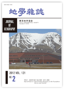
JOURNAL FREE ACCESSIn 1993, UNIS was established at Longyearbyen, Svalbard (Norway) as a research center of the Arctic sciences (geology, geophysics, biology, and engineering). Since its foundation, UNIS has promoted scientific research and studies on the Earth's cryosphere. The campus is located by a fjord and is surrounded by mountains whose glaciers flow close to the town. The ice-free tundra is dominated by a periglacial landscape and is underlain by permafrost. The table mountain in the background is composed of Cretaceous-Paleogene sedimentary rocks with horizontal strata, and is calved by a glacial cirque. A rock glacier (tongue-shaped form) at the bottom of the cirque travels downslope at a rate of about 10 cm yr−1.
(Photograph & Explanation: Norikazu MATSUOKA; Photographed on June 16, 2010)View full abstractDownload PDF (996K)
Special Issue on “Earth Surface Dynamics in the Cryosphere: Review and Outlook”
-
Norikazu MATSUOKA, Atsushi IKEDA, Kotaro FUKUI, Yohta KUMAKI, Hitoshi ...2012 Volume 121 Issue 2 Pages 181-186
Published: April 25, 2012
Released on J-STAGE: May 29, 2012
JOURNAL FREE ACCESSDownload PDF (400K)
Part I Glacial Landforms and Glaciation
Review Articles
-
Personal ReviewYugo ONO2012 Volume 121 Issue 2 Pages 187-214
Published: April 25, 2012
Released on J-STAGE: May 29, 2012
JOURNAL FREE ACCESSFifty years of studies on glacial landforms in Japan between 1960 and 2010 are reviewed from the personal perspective of a researcher who devoted a major part of his life to these studies. The 1960s was a period in which there was a paradigm shift in the history of glacial landform studies in Japan. This resulted from a series of studies by Tomoya Iozawa using aerial photograph interpretation. He was the first researcher to observe and identify all of the glacial landforms in Japan using aerial photographs, and divided them into two groups: the older and more widespread (Yokoo Stage) and the younger and much less widespread (Karasawa Stage). Following his methodology and staging, extensive research was done in the 1970s, and tephrochronological studies revealed that the older and younger stages correspond to MIS 4 and 2 respectively, although MIS 3 glaciation was recognized later in the Hidaka Range, Hokkaido. A researchers union of glacial and periglacial landforms called Kanrei-chikei Danwakai was established in 1972, Proposed and organized by Isozawa and other young students including the author, it stimulated research. In the 1980s, a reconstruction of the mass balance and flows of past glaciers from glacial landforms was attempted by the author and other researchers. This led to the estimation of the Equilibrium Line Altitude (ELA) of former glaciers in Japan. Inventory work and monitoring of perennial snow patches in the Japanese Alps were also begun in the 1980s, and they encouraged studies on the transformation from perennial snow patch to glacier. In addition, the discovery of an ice body at the bottom of Kuranosuke Cirque, Mt. Tateyama, Northern Japanese Alps gave an important hint to estimating the present (topographical) snowline altitude, which could be much lower than the former evaluation determined only from free air temperature. Both the study of perennial snow patches and mapping of the former ELA clarified the importance of precipitation when determining snowline altitude, and the present ELA was estimated at 2970 m just below the peak of Mt. Tateyama (3003 m). Since the 1990s, glacial landform studies became more closely related to global climatic change within the framework of IGBP-PAGES. Glacial fluctuations in Japan in the last glacial period were mainly controlled by monsoon changes and migration of westerlies, which caused a southern migration of the polar frontal zone. Although the glaciers in Japan were small, even in the glacial period, it is now believed that they are an important indicator of climatic changes because they are very sensitive to monsoon and westerly changes.View full abstractDownload PDF (3383K) -
Examples from the Southern Hemisphere and Asian MountainsChiyuki NARAMA2012 Volume 121 Issue 2 Pages 215-234
Published: April 25, 2012
Released on J-STAGE: May 29, 2012
JOURNAL FREE ACCESSEstablishment of a continuous, detailed glacial chronology based on radiocarbon (14C) dating has been hindered by the difficulty of collecting organic matter in cold and arid mountainous regions. The development of other numerical dating methods, such as terrestrial cosmogenic nuclide (TCN) and optically stimulated luminescence (OSL) dating, has recently made it possible to establish a detailed glacial chronology and to compare local glacial chronologies with recent climate proxy data of ice cores obtained from polar and alpine glaciers, and of deposits from sea floors and lake bottoms. This paper reviews recent studies on the glacial chronology of the Southern Hemisphere and high mountains of Asia (Himalayas, Tibet, and Central Asia). There are three main outcomes. (1) Glacial advances from the Late Glacial to Holocene in New Zealand and Patagonia were mostly synchronized with cold periods identified in Antarctic ice cores, while glaciers in the Peru Andes fluctuated oppositely but similarly to the North Atlantic. (2) Differences and similarities between local glacial chronologies in the Himalayas and Tibetan Plateau originated from the Indian monsoon and westerlies. For example, some researchers have proposed that the presence of early Holocene moraines and absence of moraines deposited in the Last Glacial Maximum (LGM) indicate an enhanced monsoon in the early Holocene because a stronger summer monsoon brings more snow to the Himalayan ranges. (3) The glacial chronologies during the Last Glacial in Central Asia, which is not influenced by the Indian monsoon, differ from those in the Himalayas. The glacier changes agree with climate proxy records from lacustrine deposits and mountain ice cores in Central Asia during the last 1000 years, which indicates the change of precipitation in the area.View full abstractDownload PDF (6601K)
Original Articles
-
Shuji IWATA, Sumiko TSUKAMOTO, Shinjiro KURODA2012 Volume 121 Issue 2 Pages 235-251
Published: April 25, 2012
Released on J-STAGE: May 29, 2012
JOURNAL FREE ACCESSThe upper Wangfeng moraine, located in the upper Urmuqi River valley, the Tianshan Mountains, China, is a cluster of hummocky moraines composed of sediments with complex lithofacies and structures (sedimentary sequence). The sediments of the Wangfeng moraine are well exposed along a road-side outcrop extending more than 500 m, and are composed of the following three lithofacies associations (LFAs). 1) Supraglacial till, diamicton with large boulders and consolidated fine matrix of higher clay content, lying at the lower half of the outcrop. 2) Supraglacial debris, and landslide and debris flow deposits from the valley slopes covering the supraglacial till. There are patches of diamictons composed of smaller boulders and sandy matrix in small parts. 3) Stratified sediments on the outer slopes of marginal moraines. At many points the bedding is inclined, dipping upstream as well as downstream; therefore, the sediments were constructed by debris flows from the glacier surface and fluvial processes. This LFA includes sediments derived from the valley side slopes by various processes. They cover the supraglacial till and occupy a large part of the outcrop. The lithfacies structures and sequence of the whole outcrop indicate that the moraine is separated into two parts: one comprises marginal moraines constructed by the main valley glacier and the other by the tributary glacier from the Qionsaersayi glaciated valley. OSL dating of fine-grained quartz shows that the supraglacial till constituting a frontal moraine at the upstream end was deposited during the global Last Glacial Maximum, and that the fluvial and debris flow sediments covering the frontal moraine from the Qionsaersayi glaciated valley were deposited during the late glacial period.View full abstractDownload PDF (1995K) -
Takanobu SAWAGAKI, Naoko MATSUOKA, Shogo IWASAKI, Kazuomi HIRAKAWA2012 Volume 121 Issue 2 Pages 252-268
Published: April 25, 2012
Released on J-STAGE: May 29, 2012
JOURNAL FREE ACCESSOne of the key sites of late Quaternary glaciations in the Hidaka Range is the Nanatsu-numa cirque area where glacial landforms and sediments can be correlated with the key marker tephra, En-a (17–18ka), which allow glacier extent and fluctuations around the LGM to be examined precisely. This site has been identified as a type locality for defining two stadials, Poroshiri Stadial (older) and Tottabetsu Stadial (younger), during the last glaciation in this area. We made a detailed description of the stratified sediments interpreted as glaciofluvial deposits, located immediately below the Nanatsu-numa cirque. We discovered that: (a) these deposits formed the proximal part of glacier terminus; (b) En-a is included in all layers of sediment to a depth of 15 m; and (c) several boulder layers show cyclical debris flow sedimentation facies, which were probably due to En-a covering the glacier surface causing a sudden ice melt. Consequently, all stratified sediments at this site were deposited during the younger stadial of the last glaciation in the vicinity of the glacial terminus.View full abstractDownload PDF (6521K)
Part II Frozen Ground and Periglaciation
Review Article
-
Norikazu MATSUOKA, Atsushi IKEDA2012 Volume 121 Issue 2 Pages 269-305
Published: April 25, 2012
Released on J-STAGE: May 29, 2012
JOURNAL FREE ACCESSPeriglacial process studies, which began in the mid-20th century, have greatly advanced in recent years following several breakthroughs. This paper reviews the latest breakthroughs supported by new technologies, themes, and international projects. New technologies have enabled small, high-resolution data loggers to monitor rock and soil movements, and thermal and hydrological properties in polar and alpine areas; enabled geophysical instruments to visualize two- and three- dimensional subsurface structures below periglacial features; and, enabled numerical simulations to predict future landform evolution. In particular, dramatic progress has been achieved in understanding bedrock shattering and falls, soil movements induced by freeze-thaw oscillations, controls on rock glacier creep, critical conditions for ice-wedge cracking, and biogeophysical impacts on non-sorted circles. Two key words, global warming and Mars, are appearing often in periglacial research. High mountains and polar lowlands face the fate of potential natural hazards associated with rock slides, debris flows and thermokarst subsidence, possibly originating from permafrost thawing. High-resolution orbital images and on-site explorations on Mars provide detailed information on small-scale, potential periglacial features, which are the morphologically equivalent of terrestrial counterparts. International collaboration is expected to further promote modeling various periglacial features on a global scale, improve the resolutions of periglacial climate indicators, and increase understanding of past and present Martian environments.View full abstractDownload PDF (3119K)
Original Article
-
Atsushi IKEDA, Go IWAHANA, Tetsuo SUEYOSHI2012 Volume 121 Issue 2 Pages 306-331
Published: April 25, 2012
Released on J-STAGE: May 29, 2012
JOURNAL FREE ACCESSOn September 2010, the Japanese mass media reported that permafrost had disappeared throughout the altitudes of 3300–3600 m asl. on the south-facing slope of Mt. Fuji (3776 m asl.) within 12 years because of climatic warming. However, no evidence (data and analyses) has been published in scientific journals. In this paper, we show ground freeze-thaw patterns above the tree line of Mt. Fuji based on recent year-round records of temperatures at shallow depths at 22 sites. The shallow ground temperatures became significantly warmer from the 2008–2009 period to the 2009–2010 period because the latter period had irregular snow accumulation at several sites and extremely sunny hot summer. The snow cover on Mt. Fuji generally prevented the ground from cooling rather than from warming. In addition, records for some locations show rapid ground warming in late summer, which accompanied heavy rainfall events. The mean annual temperatures at the ground surface on the south-facing slope were 1.5 to 3°C higher than those on the north-facing slope at the same altitude. Considering these characteristics, we interpret that the presence of permafrost is probable only at 5 sites on north- to west-facing windy locations above 3500 m asl., although studies in the 1970s suggest that the lower boundary lay at around 3000 m asl. on both north- and south-facing slopes. However, it is clear that, in the 1970s, the estimation of permafrost distribution on Mt. Fuji was based not on thaw depths at the end of thawing period (late September to mid October), but on those in the middle of thawing period (late July to August). The resulting overestimation of the permafrost distribution may have led to tales of extremely rapid permafrost degradation. Permafrost research on Mt. Fuji is still at its initial stage and long-term monitoring of ground temperatures is required to evaluate the impacts of changes of climate and volcanic activity on the surrounding environment.View full abstractDownload PDF (3304K)
Short Articles
-
Ground Temperature, Frost Heave, and Slow Mass Movement Measurements at Eagle Summit, Central AlaskaShin-ichi SAWAGUCHI2012 Volume 121 Issue 2 Pages 332-341
Published: April 25, 2012
Released on J-STAGE: May 29, 2012
JOURNAL FREE ACCESSGround temperature, frost heave, and slow mass movement were measured on a debris-mantled slope at Eagle Summit, central Alaska from 2004 to 2008. The maximum and minimum temperatures at the ground surface during the measurement period were 25.7°C on 4 July 2007 and −32.7°C on 28 February. The mean annual ground surface temperature was −3.1°C.
Subsurface isotherms indicate that seasonal freezing starts from late September to early November, and that seasonal frost begins to melt in mid-May. The thawing front reached a depth of 80 cm in 8 days. The maximum height of the seasonal frost heave at the ground surface reached about 2.0 cm during the early period of seasonal freezing.
Twenty diurnal freeze-thaw cycles occurred in spring, but less than 10 in autumn. Short-term frost heave corresponded to diurnal freeze-thaw cycles at the ground surface. The cumulative amount of short-term and seasonal frost heave between 2004 and 2008 was 22.1 cm. Using this value, the potential frost creep is calculated to be 2.5 cm/yr on the 20° slope.
On the other hand, the annual average movements measured with two painted stone-lines were only 0.3 mm and 0.4 mm, which is considerably smaller than potential frost creep. The small surface movement probably reflects the presence of vegetation patches and uneven subsurface materials. Therefore, the value of potential frost creep (2.5 cm/yr) probably represents the average surface movement in this area. In terms of the frequency of freeze thaw-cycles and the value of potential frost creep, mountains in central Alaska have intermediate characteristics between the mid-latitude alpine area and Arctic.View full abstractDownload PDF (2761K) -
Masafumi AOYAMA2012 Volume 121 Issue 2 Pages 342-358
Published: April 25, 2012
Released on J-STAGE: May 29, 2012
JOURNAL FREE ACCESSAir and ground temperatures on a periglacial smooth slope at Mt. Minamidake (3,033 m a.s.l.), northern Japanese Alps, were observed and used to compare periglacial conditions between alpine areas in Japan and Switzerland. These temperature data were combined with morphometric parameters to discuss periglacial processes forming a bouldery lobe and a pebbly lobe on the smooth slope.
Freezing indices at the study site are smaller than indices in permafrost areas of Mt. Fuji and of the Daisetsu Mountains, Hokkaido. Mean annual air temperatures at the study site were within the boundary values for the presence of mountain permafrost. Mean annual ground surface temperatures on the studied slope are comparable to or colder than those at the lower limit of permafrost in the Swiss Alps. Thus, ground surface temperatures on the studied slope indicate the presence of permafrost, unless an advective heat flow such as rainwater infiltration disturbs subsurface temperatures. The bouldery lobe has a smaller riser height than a typical rock glacier, but a larger one than a typical solifluction lobe. The morphometric parameters of the pebbly lobe are comparable to typical solifluction lobes, which originate from annual frost creep and gelifluction. The surface of the bouldery lobe lacks interstitial fine materials, and that of the pebbly lobe is partly composed of a fine debris layer. These conditions suggest that permafrost creep is responsible for the development of the bouldery lobe, while the pebbly lobe originates from annual frost creep and gelifluction.View full abstractDownload PDF (3641K)
Letter
-
Chousei SHIMIZU, Nobuyuki YAMAKAWA, Masaki ISHII, Misae FUJIMORI, Kait ...2012 Volume 121 Issue 2 Pages 359-366
Published: April 25, 2012
Released on J-STAGE: May 29, 2012
JOURNAL FREE ACCESSGround ice and temporary lake were studied in the Jigokudani Crater (N36°03′44.82″, E138°20′45.82″) in a northern area of the Yatsugatake Volcanic Chain (Kita-yatsugatake). The crater, which is about 30 m deep, is located at 2108 m a.s.l., and is surrounded by subalpine coniferous forest where the mean annual air temperature is about 3°C. The ground ice survived in summer mainly because cold air blew down through voids between andesite blocks composing the crater wall. The ice remained throughout 2009, although it melted completely in September 2010. In 2010, a crater lake appeared in May and disappeared in early August. This survival period of the lake was probably much longer than in other years. We consider that the melting of ground ice was promoted by the long-lasting lake having a slightly positive temperature which contacted the ice directly.View full abstractDownload PDF (1261K)
Part III Geoecology and Slope Dynamics
Review Article
-
Kuniyasu MOKUDAI2012 Volume 121 Issue 2 Pages 367-383
Published: April 25, 2012
Released on J-STAGE: May 29, 2012
JOURNAL FREE ACCESSIWATA Shuji and KOIZUMI Takeei initiated Japanese geoecology studies in the 1970s. The Colloquium of Cold Region Landform (Kanrei Chikei Danwakai) contributed significantly to Koizumi's studies. Early geoecological studies have been classified into two categories: analysis of landscape structure and research on phytogeography. The former is similar to the general system theory. This concept is a good method for understanding the natural landscape and for resolving regional issues. The latter relates to systematic geography. These studies are mainly conducted in mountain areas. While studies on natural environments in mountain areas have advanced, Japanese geoecological studies seem to have focused on special areas.
Furthermore, research trends of Japanese geoecological studies were analyzed by examining competitive funding practices. The results illustrate that there have been three types of study since the 1980s: (1) phytogeographical studies and analysis of the landscape structure in cold regions such as polar and high mountain areas; (2) comprehensive geographical overseas studies; and, (3) problem-solving research on regional issues such as resource management and countermeasures for natural disasters. Currently, phytogeographical studies and problem-solving research are advancing. However, Japanese geoecological studies have not appealed to researchers in different fields until now. The future development of geoecological research requires interdisciplinary research.View full abstractDownload PDF (1366K)
Original Article
-
Yoshihiko KARIYA, Go SATO, Jiro KOMORI2012 Volume 121 Issue 2 Pages 384-401
Published: April 25, 2012
Released on J-STAGE: May 29, 2012
JOURNAL FREE ACCESSThis paper describes landslide features observed in the Nagashirisawa Basin and Kanayamazawa Basin east of Mount Shiroumadake (central Japan), where mid- to late-Pleistocene mountain glaciers are thought to have developed. Geomorphological analyses accompanied by a study of airphoto interpretation and a geological survey show gentle slopes, low-relief ridges and mounds in the basins. In most cases, angular gravels in major deposits of these landforms comprise either one or a few kinds of bedrocks exposed near the slopes. No gravels originating from any other geology in the basins are found. Jigsaw-brecciated clasts and folded-elongated silt patches in the major deposits can also be distinguished. Landslide processes, including the gravitational deformation of bedrock (i.e., mass rock creep), are probable causes of these features. Chronological information suggests that a major landslide occurred during the period from late Pleistocene to late Holocene. The triggers of these landslides remain incompletely understood, glacial–interglacial climate changes along with precipitation variations, as well as paleoearthquakes originating from nearby active faults, might be important. Some landslides found in the basins overlap moraines identified by previous research. Historical geomorphology of this area requires further study.View full abstractDownload PDF (4671K)
Short Article
-
Sadao TAKAOKA, Yoshihiko KARIYA, Go SATO2012 Volume 121 Issue 2 Pages 402-410
Published: April 25, 2012
Released on J-STAGE: May 29, 2012
JOURNAL FREE ACCESSLittle is known about the biotic and abiotic characteristics of alpine ponds and lakes even though they are prominent and important features of alpine landscape. This study examines the influence of gravitational landforms on the origins and spatial distribution of alpine ponds in a landslide-prone area in central Japan. Ninety-four ponds were detected by aerial-photo interpretation in an area above 2000 m a.s.l. (7838 ha) in a northern area of the Northern Japanese Alps. Of these, 60 ponds occurred inside or at the outer boundaries of gravitationally displaced masses, and 27 ponds occurred in linear depressions that were formed outside masses displaced by gravitational force; the remainder of the ponds were formed by volcanic activities. A logistic regression analysis was performed to determine whether environmental variables explain the presence of ponds in linear depressions. The results indicate that presence of ponds is related to the depth of a depression, snow-cover duration, and bedrock geology. Deeper depressions have ponds more frequently, and ponds tend to be found in depressions on snowy slopes underlain with ultramafic rocks. The concentration of alpine ponds in snowy, ultramafic rock areas suggests ponds are mainly fed by snow melt, and that soil material from weathered ultramafic rocks supports the water storage of ponds.View full abstractDownload PDF (1334K)
Pictorials
-
Chiyuki NARAMA2012 Volume 121 Issue 2 Pages iii
Published: April 25, 2012
Released on J-STAGE: May 29, 2012
JOURNAL FREE ACCESSDownload PDF (1162K) -
Chousei SHIMIZU2012 Volume 121 Issue 2 Pages iv
Published: April 25, 2012
Released on J-STAGE: May 29, 2012
JOURNAL FREE ACCESSDownload PDF (1544K) -
Norikazu MATSUOKA2012 Volume 121 Issue 2 Pages v-vi
Published: April 25, 2012
Released on J-STAGE: May 29, 2012
JOURNAL FREE ACCESSDownload PDF (3779K)
- |<
- <
- 1
- >
- >|