巻号一覧
119 巻 (2010)
- 6 号 p. 947-
- 5 号 p. 775-
- 4 号 p. 585-
- 3 号 p. 421-
- 2 号 p. 187-
- 1 号 p. 1-
119 巻, 4 号
選択された号の論文の14件中1~14を表示しています
- |<
- <
- 1
- >
- >|
表紙
-
2010 年 119 巻 4 号 p. Cover04_1-Cover04_2
発行日: 2010/08/25
公開日: 2010/11/08
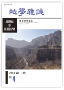
ジャーナル フリー山西省東縁の太行山脈に位置する万仙山国家地質公園(国家4A級景区)には地層の構成岩石の侵食作用の差により美しい組織地形がみられる.峡谷沿いは太古代(約25億年前)の変成岩類,不整合で急峻な崖をつくる原生代末期の石英質赤色砂岩が覆う.整合的に崩れやすいカンブリア紀の頁岩・砂岩互層,上位にはオルドビス紀の浅海性石灰岩層が重なる.スカイラインの最も凹んでいる部分が標高1,700mの王莽嶺国家地質公園の展望台が見える.山頂が山西省と河南省の境界をなす.
(清川昌一)抄録全体を表示PDF形式でダウンロード (1166K)
論説
-
―5系統の断層発達史―森 慎一, 藤岡 換太郎, 有馬 眞2010 年 119 巻 4 号 p. 585-614
発行日: 2010/08/25
公開日: 2010/11/08
ジャーナル フリーThis paper describes topographic and geologic features of the northern part of the Sagami Trough and surrounding areas, off central Japan, and discusses the role of the Philippine Sea plate in the development of the trough's topography and fault systems. In the study area, the Okinoyama Bank Chain, Miura Basin Chain, and several spurs are aligned NW-SE parallel to the axis of the Sagami Trough. We examine the lithological compositions of rock and piston-core samples collected from the R/V Hyper Dolphin during Japan Agency for Marine-Earth Science and Technology dives 906 and 907, and rock samples dredged during Ocean Research Institute of the University of Tokyo cruise KT88. These samples represent mainly volcaniclastic rocks derived from the volcanoes of the Izu arc and subordinate amounts of terrigenous sediment interpreted as derived from the Sagami and Sakawa Rivers.
The topographic and geologic data define five fault systems in the eastern part of the northern Sagami Trough. We interpret the Okinoyama Bank Chain as an elevated outer-ridge belt developed at the landward slope of the plate boundary, which is represented by NW-SE trending right-lateral reverse faults (F1). At the northeast side of the Okinoyama Bank Chain, NW-SE trending normal faults (F2) formed and the Miura Basin Chain developed. The cutting relationship between these fault sets suggests that the collision of the Izu arc with the Honshu arc imposed a right-lateral shear stress field on the Okinoyama Bank and Miura Basin Chains. This shear stress may have led to clockwise rotation of these tectonic blocks formation of a set of NE-SW trending left-lateral reverse faults (F3). The initiation of the Izu block collision is interpreted as a turning point after which the northward motion of the Philippine Sea plate abruptly changed to NW and the Sagami Bay area came under a NW-SE compressional stress field, which resulted in the development of E-W trending right-lateral faults (F4) in the narrow shelf off the Miura Peninsula. A number of spurs subsequently developed along these faults. Finally, NNE-SSW trending right-lateral normal faults (F5) developed under an E-W extensional stress field, which caused the formation of N-S trending topographic depressions such as Tokyo Canyon and submarine highs such as Okinoyama and Oiso Spur.抄録全体を表示PDF形式でダウンロード (6475K) -
―ニューイングランドにおける捕鯨中心地の近代綿工業地への転換―大崎 晃2010 年 119 巻 4 号 p. 615-631
発行日: 2010/08/25
公開日: 2010/11/08
ジャーナル フリーThis study examines the American whaling industry, which was based in New England and dominated most of the Western oil market in the 18th and 19th centuries. Previous studies by the author examined why the industry was attracted to this region, highlighting the favorable economic environment of the area, which allowed investors to accumulate the necessary funds to launch whaling ventures. Each investment consortium that provided funds to whaling vessels organized limited partnerships with individual vessels. This enabled consortiums to collect funds from a variety of stakeholders other than just businessmen involved in whaling and their families. Crewmembers of the vessel, reflecting the multi-racial society of the United States, were also free to select employers without relying on a conventional employer-employee relationship. Taken together, these factors led to New England attracting funds and labor from both within the region and further afield, and developing into the whaling center of the United States.
An additional reason for New England's development as a whaling base was the global expansion of the industry to cover the Atlantic, Pacific, and Indian oceans, with only the Southern Ocean not affected by this growth. Crewmembers were also paid from a ship's profits using the lay system. This payment by piece ratio ensured a minimum payment to crewmembers while guaranteeing a return for investors. The hiring of native islanders as part-time laborers in the whalers' areas of operation also kept expenditure to a minimum, with all of these factors contributing to investors' profits.
Against this background, the whaling industry prospered and profited up until the 1850s. In the 1870s, however, the industry started to decline as whale resources decreased and the price of whale oil fell as a result of increased petroleum production. This study examines the details of how whaling voyages were managed during this period and how New England's whaling industry underwent a rapid transformation into a mechanized cotton industry with the owners of whaling vessels switching their investments to the cotton industry at New Bedford, the center of the whaling industry in New England. The rapid change from industrial whaling to the mechanical cotton industry in New England was made possible with the abundant funds accumulated by the whaling industry. The reestablishment of consortiums progressed smoothly as limited partnerships already existed and the labor market adapted efficiently from supplying whaling vessels to supplying female workers for the cotton industry due to the presence of non-conventional employment rules.
We can see, therefore, in this region the development from one industry to another was controlled only by market-based mechanisms of American management. This is in sharp contrast to the Japanese fishing industry, which developed from a manufacturing fishery through technological innovation and utilizing community manpower or industrial power as the only motive force under limited investment and labor market conditions.抄録全体を表示PDF形式でダウンロード (1322K) -
―海面変化とテクトニクスに関連して―長岡 信治, 西山 賢一, 井上 弦2010 年 119 巻 4 号 p. 632-667
発行日: 2010/08/25
公開日: 2010/11/08
ジャーナル フリーThe Miyazaki Plain is situated at the western end of the forearc of the Southwest Japan Arc, and is one of the standard areas of the Quaternary system in Japan. Many tephra layers were supplied from volcanoes in the Ryukyu and Southwest Japan arcs during Quaternary. The authors establish the stratigraphy and chronology of sediments during middle Pleistocene to Holocene in the Miyazaki Plain using tephrochronological methods, and discuss landform development and tectonics.
The sediments are subdivided into Kariya formation, Nojiri formation (the Highest terraces), the Higher terrace deposits, the Middle terraces deposits, the Lower terraces deposits, and the Holocene formation (alluvium plain). Kariya formation of 1 Ma-500 ka, is fluvial sediments which are partially accompanied by marine sediments. Nojiri formation is 500-300 ka old and fluvial and marine sediments form the highest terraces. Shiinoki member in Nojiri formation has a transgressive sediment and is correlated with MIS 9. The higher terraces are composed of Kukino fluvial terrace of 330-240 ka and Chausubaru fluvial terrace of 240 ka. The middle terraces consist of the four fluvial and marine terraces: Sanzaibaru terrace of 140-120 ka, Baba terrace of 110 ka, Nyutabaru terrace of 110-90 ka, Karasebaru terrace of 90 ka, and Saitobaru terrace of 90-80 ka. Sanzaibaru terrace with a thick transgressive sediment and well-developed marine terraces correlates with MIS 6-5e. Nyutabaru terrace is mainly fluvial accompanied partially by marine terraces, and emerged in MIS 5c. Baba and Saitobaru terraces are fluvial only. Saitobaru terrace with a gravel bed over 10-m thick indirectly corresponded to the transgression in MIS 5a. All of the lower terraces of 70-10 ka are fluvial, and are subdivided into ten terraces: Shimizu, Okatomi, Toyobaru 1, Toyobaru 2, Ikazuno, Oyodo, Fukadoshi 1, Fukadoshi 2, Mikazukibaru 1, and Mikazukibaru 2. Their steep longitudinal profiles indicate that sea-level when the terraces formed was lower than the recent one. This lower sea-level stage chronologically corresponds to MIS 4-2. Fukadoshi 1,2 terraces, the profile of which is the steepest of all the terraces, were formed in MIS 2, the last glacial maximum. Shimotajima marine terraces and recent alluvium correspond to Holocene high sea level and transgression in MIS 1.
The tectonics of the Miyazaki Plain during the past 2 Ma are estimated from landforms and geological structures. During 2-1 Ma, the forearc basin beneath the sea was uplifted slowly and the Miyazaki Plain emerged. Then the left-lateral movement of Wanitsuka Mts block bordering the plain on the north formed the two pull-apart basins of the Kariya and Nojiri formations at the southern part of the plain during 1-0.3 Ma. The left-lateral movement was caused by the opening of the Okinawa Trough in the back arc of Ryukyu Arc. At 0.3 Ma, the Miyazaki plain suddenly began uplifting rapidly due to E-W trend compression. During 0.8-0.6 Ma, the movement direction of the Philippine Sea Plate changed from NW to WNW, and then the plate subducted obliquely along the Nankai trough. Consequently, the Southwest Japan forearc including the Miyazaki Plain decoupled from the inner arc, moving westward, and finally caused the E-W trend compression and uplifting around the Miyazaki Plain. The uplift rate of the southern part of the plain accelerated from 0.1 m/ka to 1 m/ka during the last 0.3 Ma at the southern part of the plain. In detail, the tectonical mode is domical uplifting the center, which is several kilometers off Miyazaki City in the Pacific Ocean. The domical uplifting and the increasing uplift rate relate to the isostasy of the subducting Kyushu-Palau Ridge on the Philippine Sea plate under the Miyazaki Plain or a rising serpentinite diapir in the crust of the Eurasia plate.抄録全体を表示PDF形式でダウンロード (7280K) -
―濃尾平野西縁におけるボーリングコアの解析から―丹羽 雄一, 須貝 俊彦, 大上 隆史, 田力 正好, 安江 健一, 藤原 治2010 年 119 巻 4 号 p. 668-682
発行日: 2010/08/25
公開日: 2010/11/08
ジャーナル フリーA 6000-year history of relative sea-level change on the western Nobi plain, at the footwall side of the Yoro fault, was reconstructed from three drilling cores based on analyses of sedimentary facies, grain-size distributions and electrical conductivity (EC), as well as 20 14C age determination. The Yoro fault comprises the northern part of the Yoro fault system. These cores show a prograding delta sequence. Two intervals characterized by fine deposits, mainly composed of fine sand, and high EC value are identified in sandy delta front deposits showing a general coarsening upward sequence. In synchronous with these changes in the delta front, a rapid rise of EC value is recognized in the abandoned channel fill deposits on the delta plain. These data suggest that temporal sea-level rise events occurred during the progradation process of the delta system. A probable cause of these events is coseismic subsidence. These subsidence events are dated at around 5600-4700 cal BP and 4600-3800 cal BP, respectively.
The above-mentioned subsidence events broadly correspond with previously known faulting events at the Kuwana fault to the south of the Yoro fault. Evidence for the faulting of the Yoro and Kuwana faults associated with two historical earthquakes (AD 745 and AD 1586) accompanied by coseismic subsidence and synchronicity of the subsidence events identified in this study and faulting events at the Kuwana faults suggest that subsidence events identified in this study are caused by faulting at the Yoro fault. These results are consistent with the notion that the Yoro and Kuwana faults comprise a behavioral segment in the Yoro fault system.抄録全体を表示PDF形式でダウンロード (1742K) -
小松原 琢, 関西地質調査業協会地盤情報データベース作成委員会 , 束原 純, 佐野 正人, 藤原 重彦, 木村 浩, 矢野 晴彦, 中島 ...2010 年 119 巻 4 号 p. 683-708
発行日: 2010/08/25
公開日: 2010/11/08
ジャーナル フリーThis study clarified the stratigraphy and sedimentary facies of the shallow subsurface strata of the Ohmi Basin, an inland lake basin in central Japan. Stratigraphic divisions in the basin are based on regional tephra and widely distributed humic layers. The shallow subsurface strata of the basin are divided into two units. Unit II comprises middle to upper Pleistocene terrace deposits. The overlying Unit I comprises uppermost Pleistocene to Holocene postglacial deposits. Although the lithofacies of Unit II vary horizontally and vertically, the uppermost part consistently consists of humic soils containing Aira-Tn tephra (AT). This distinctive tephra is widely distributed throughout the Japanese islands. Humic soils were deposited at ca. 16.5 to 25 ka according to 14C dating. Unit I, which conformably overlies Unit II, and is mainly a repetitive succession of sand, mud, and gravel. Each layer is discontinuous in terrestrial areas, where distribution patterns of lithofacies are controlled by topography. The depth distribution of AT reflects tectonic subsidence induced by reverse faulting in the Biwako-Seigan active fault zone on the western side of Lake Biwa. Thus, tectonic movement was an important factor during sedimentation. Periodic small-scale subsidence (less than several meters per event) due to slips along faults of the Biwako-Seigan system caused discontinuities in late Quaternary fluvial deposits.抄録全体を表示PDF形式でダウンロード (15385K)
資料
-
日本地学史編纂委員会 東京地学協会2010 年 119 巻 4 号 p. 709-740
発行日: 2010/08/25
公開日: 2010/11/08
ジャーナル フリーPDF形式でダウンロード (862K)
東京地学協会第13回海外巡検報告
-
清川 昌一2010 年 119 巻 4 号 p. 741-750
発行日: 2010/08/25
公開日: 2010/11/08
ジャーナル フリーThe Geopark in the Taihang Mountains is one of the best-developed World Geoparks in China. We undertook a geological field trip to the Geopark. The geology of the Taihang Mountains comprises Archean-Proterozoic metamorphic basements, Neoproterozoic red sandstone, and Cambrian shale, with Ordovician limestone at the top. The well-preserved stratigraphy of these sequences form a structural landform comprising an unusual mountain and valley system topography.
Recently, the Chinese government designated the area a national reserve. There are 22 World Geoparks preserved in China, which is largest number in any country worldwide. During this trip, we observed the present situation of the Geopark in the Taihang Mountains area.抄録全体を表示PDF形式でダウンロード (1653K)
書評・紹介
-
明石書店,2009年2月渡辺 悌二2010 年 119 巻 4 号 p. 751-752
発行日: 2010/08/25
公開日: 2010/11/08
ジャーナル フリーPDF形式でダウンロード (342K) -
朝倉書店,2008年11月10日吉永 秀一郎2010 年 119 巻 4 号 p. 752-754
発行日: 2010/08/25
公開日: 2010/11/08
ジャーナル フリーPDF形式でダウンロード (348K) -
朝倉書店,2010年2月小荒井 衛2010 年 119 巻 4 号 p. 754-755
発行日: 2010/08/25
公開日: 2010/11/08
ジャーナル フリーPDF形式でダウンロード (344K) -
2010年6月清水 長正2010 年 119 巻 4 号 p. 755
発行日: 2010/08/25
公開日: 2010/11/08
ジャーナル フリーPDF形式でダウンロード (337K)
口絵
-
長岡 信治, 西山 賢一, 井上 弦2010 年 119 巻 4 号 p. v-vi
発行日: 2010/08/25
公開日: 2010/11/08
ジャーナル フリー南九州の宮崎平野は多数の河成・海成段丘が発達し,九州の第四系の代表的模式地のひとつとされてきた.しかしながら,中期更新世やそれ以前の堆積物の層序や対比,年代については不明な点が多かった.しかし,今回,テフロクロノロジー的手法によりそれらの層序が確立され,過去100万年間の宮崎平野の形成過程とテクトニクスが推定された(長岡ほか, 2010).抄録全体を表示PDF形式でダウンロード (1906K) -
清川 昌一2010 年 119 巻 4 号 p. vii-viii
発行日: 2010/08/25
公開日: 2010/11/08
ジャーナル フリー山西省東縁に位置する太行山脈は南北に400kmにわたり,標高は1,500~2,000m山脈をつくる.ここでは,先カンブリア紀から古生代にかけての連続した地層が侵食により切り立った風光明媚な地形をしており,地質公園として広く保護されている.本口絵は東京地学協会主催の海外巡検時に訪れた公園内の地形・地質を紹介する(清川,2010).抄録全体を表示PDF形式でダウンロード (3120K)
- |<
- <
- 1
- >
- >|