巻号一覧
120 巻 (2011)
- 6 号 p. 889-
- 5 号 p. 725-
- 4 号 p. 567-
- 3 号 p. 439-
- 2 号 p. 249-
- 1 号 p. 1-
120 巻, 5 号
選択された号の論文の21件中1~21を表示しています
- |<
- <
- 1
- >
- >|
表紙
-
2011 年 120 巻 5 号 p. Cover05_1-Cover05_2
発行日: 2011/10/25
公開日: 2012/01/17
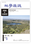
ジャーナル フリー南オーストラリア州のマウントガンビアの都市中心地に隣接してマウント・ガンビアの火山丘がある.マウント・ガンビアは標高190mで,オーストラリアで最も新しい火山の1つであるが,死火山になっている.この火山にはブルーレイクやバリーレイクなど4つの湖から構成されるマール群がある.マール群は約4,300年前,あるいは約28,000年前に形成されたと論争されている.マウント・ガンビアの山頂に建てられたセンチュアリー・タワー(百周年記念塔)からのパノラマは,マール群の景観を観察する最もよい場所の1つとなっている.バリーレイクは他の3つの湖とともに,人気のある観光アトラクションになっており,湖を中心としたジオツーリズムは地域振興に大きく貢献している.
(菊地俊夫・有馬貴之)抄録全体を表示PDF形式でダウンロード (1195K)
特集号:ジオパークと地域振興
-
Toshio KIKUCHI, Shuji IWATA, Mahito WATANABE, Jun MATSUMOTO, Hitoshi K ...2011 年 120 巻 5 号 p. 725-728
発行日: 2011/10/25
公開日: 2012/01/17
ジャーナル フリーPDF形式でダウンロード (104K) -
―巻頭言―菊地 俊夫, 岩田 修二, 渡辺 真人, 松本 淳, 小出 仁2011 年 120 巻 5 号 p. 729-732
発行日: 2011/10/25
公開日: 2012/01/17
ジャーナル フリーPDF形式でダウンロード (266K)
総説
-
渡辺 真人2011 年 120 巻 5 号 p. 733-742
発行日: 2011/10/25
公開日: 2012/01/17
ジャーナル フリーAccording to the guideline of the Global Geoparks Network (GGN) supported by UNESCO, a geopark must be an area that has geoheritages and other natural and cultural heritages with clearly defined boundaries and a large enough in area to serve local economic and cultural development through geotourism. A geopark must integrate sites of significant geoheritage in a strategy for sustainable regional socio-economic development and must be based on strong local community support and professional management structures.
The GGN was established in 2004 with the support of UNESCO. Since then the concept of the GGN has received global acceptance and it now has 77 members from 25 countries including four geoparks in Japan as of April 2011.
Activities to establish geoparks in Japan started in 2005 and accelerated in 2007 with cooperation from academic societies related to earth sciences and local municipalities. The Japan Geopark Committee (JGC) was established in 2008 to have aspiring geoparks in Japan evaluated by academic societies. The JGC decided the first three candidate areas in Japan to apply for the GGN in October 2008 and endorsed the first seven national (domestic) geoparks including above-mentioned three candidates for the GGN in December 2008. The Japanese Geoparks Network (JGN) was established in February 2009 by the seven national geoparks. Four more geoparks were endorsed by the JGC and joined the JGN in October 2009. As of May 2011 JGN has fourteen geoparks including four global geoparks, namely Itoigawa, Sanin Coast, Toya-Usu, and Unzen.
Geoparks in Japan play important roles in educating people about the earth sciences and disaster mitigation. Support given by scientists and the local people themselves to local communities is crucial for fostering education on the earth sciences in geoparks.抄録全体を表示PDF形式でダウンロード (621K) -
菊地 俊夫, 有馬 貴之2011 年 120 巻 5 号 p. 743-760
発行日: 2011/10/25
公開日: 2012/01/17
ジャーナル フリーAlthough there is only one geopark in Australia, there are many geosites and associated clusters. These geosites form the base of geotourism in Australian national and provincial parks and in nature conservation areas. According to the geosites' geographical range and the networks they generate, Australian geotourism can be divided into three types: small-scale, medium-scale, and large-scale geotourism.
Small-scale geotourism is characterized by the local distribution of geosites and of the networks they form. In the Willandra Lakes Region, for example, the regional development of geotourism is limited to a local cluster of geosites and their immediate surroundings. At such a local scale, geotourism does not contribute much to the sustainability of regional development because the relationship between geosites and other regional resources is not strong and does not generate organic networks. This type of geotourism is similar to ecotourism, and the linkage with eco-sites and conservation is important. Medium-scale geotourism is characterized by a broader regional distribution and occurs in combination with a small number of national and provincial parks, and with nature conservation areas such as the Greater Blue Mountain Region. Although geosites and their clusters are linked with some other kinds of regional resource in this type of geotourism, they remain dominated by bio-resources and the natural landscape. This type of geotourism generally complements mass-tourism in areas that are easily accessible from urban areas. On the other hand, large-scale geotourism is characterized by its broader spread and a wider network of geosites such as the Kanawinka Region, where the geopark is located, stretching over large areas of Victoria and South Australia Provinces. In spite of the dispersion of geosites, the relationships among them are strong and the linkage with additional regional resources contributes to the development of geotourism. Therefore, this type of geotourism makes an important contribution to the sustainability of regional development because the relationships among geosites and other regional resources generate multi-functional networks, and thus offers a diversity of tourism options.抄録全体を表示PDF形式でダウンロード (24131K) -
小泉 武栄2011 年 120 巻 5 号 p. 761-774
発行日: 2011/10/25
公開日: 2012/01/17
ジャーナル フリーA geopark involves not only a geological heritage but also geographical and ecological elements. Therefore, subjects related to geotourism are not only landforms and geology, but also ecosystems, including vegetation and animal communities, and human landscapes, such as terraced rice paddies and grasslands created by human activity. Because geotourism covers a broad range of elements, from geo- and ecosystems to human activities, it is expected that the further development of related activities will be supported and approved by an increasing number of people.
In this manuscript, I introduce some examples of geo-ecotourism as a special type of geotourism, including: vegetation at the summit area of Mount Hakusan, vegetation in a landslide scar on Mount Bandaisan, and the habitat of Dicentra peregrine on Mount Yatsugatake. These were all very popular with the participants of excursions I conducted.
Geotours also promote regional development because they benefit residents economically by employing local workers and travel-related businesses, and encourage consumption of local services and products by visitors. A pressing issue concerning geotourism in Japan is the development of human resources such as tour guides. A geotour needs an excellent guide with a riveting interpretation. There are, however, few of such guides and there is a need to rapidly foster more. As a model for fostering guides, I introduce my “Intensive course on the natural history of mountains,” which interprets the natural history of mountains based on geo-ecology. In the long term, however, it is necessary to introduce natural history education into the school system and improve the quality of nature programs broadcast on TV.
Many participants of geotours are middle aged and older, and tend to be energetic and slow to age. This may be because the tour participants are required to do physical activity and to use their common sense. Based on this perspective, a geopark approach must gain in importance within social and lifelong education.抄録全体を表示PDF形式でダウンロード (2174K) -
―「ジオ」の視点を持続的地域社会づくりに生かすために―河本 大地2011 年 120 巻 5 号 p. 775-785
発行日: 2011/10/25
公開日: 2012/01/17
ジャーナル フリーArguments on geoparks and geotourism have grown heated in recent years. However, few people can understand what “geo” means. This study considers how to share viewpoints of “geo” to build sustainable regional societies from a geographical perspective. First, the author defines geotourism as a type of ecotourism mainly focusing on the Earth's scientific resources. Second, the author argues that the concept of regional diversity proposed by the Japanese Geographical Union in 2005 is the core of Geography. The author has this concept connect the three existing concepts of the geosphere: biodiversity, cultural diversity, and geodiversity. Then, the author discusses promoting geotourism with the concept of regional diversity and familiar geographical views that are important for building sustainable societies. A geographical approach is inevitable for showing the relationship between our lives and “geo”. Humankind will have a better future by locating the geotourism as the main practice of “Earth Science for Society,” which was the slogan of the International Year of Planet Earth 2007-2009 (IYPE), and sustaining activities to develop ways of looking at “regional diversity”.抄録全体を表示PDF形式でダウンロード (857K)
論説
-
―ジオパーク推進における大学の活動例―天野 一男, 松原 典孝, 細井 淳, 本田 尚正, 小峯 慎司, 伊藤 太久2011 年 120 巻 5 号 p. 786-802
発行日: 2011/10/25
公開日: 2012/01/17
ジャーナル フリーThe activities of Ibaraki University in the North Ibaraki Geopark Project mainly comprise designing the framework of the geostory, planning and carrying out geotours, training interpreters for the geosites and constructing an information network system using social networking service (SNS). In this paper we present a case study on the role of the university in the geopark project. The activities of the academic staff and a project team made up of undergraduate and the graduate students of Ibaraki University using geological information for the North Ibaraki Geopark Project is explained. Ibaraki University promotes the geopark project and thus contributes to the regional development in the northern Ibaraki area.抄録全体を表示PDF形式でダウンロード (3149K)
総説
-
目代 邦康2011 年 120 巻 5 号 p. 803-818
発行日: 2011/10/25
公開日: 2012/01/17
ジャーナル フリーGeoconservation for geographical and geological phenomena is the most important concept associated with a geopark scheme. However, there is not enough discussion on geopark activities in Japan. Japanese Earth scientists have acted individually to conserve the natural environment, but large-scale conservation projects have not been carried out as activities of research organizations of academic societies. One of the contributions the Earth sciences have made to society is to report the scientific value of regional natural environments. Japanese Earth scientists should make detailed inventories of landforms, strata, and soil and evaluate them. Earth scientists will be able to contribute to conserving nature and sustainable development of regions through these activities. The RIGS system of the United Kingdom is a good model.抄録全体を表示PDF形式でダウンロード (662K)
論説
-
竹之内 耕2011 年 120 巻 5 号 p. 819-833
発行日: 2011/10/25
公開日: 2012/01/17
ジャーナル フリーGeopark is a beneficial tool for regional development that makes use of characteristic natural and cultural resources, such as landform, rocks, animals, and plants, as well as human history, culture, and traditions in an area. Geopark as a system includes promoting regional development based on integrating three fundamental elements of geopark activity, i.e., conservation, education, and geotourism. Itoigawa Geopark was designated a member of the Global Geopark Network with assistance from UNESCO on 22 August 2009. Itoigawa is a small city with a population of about 48,000 located on the coast of the Japan Sea close to mountains. Following its recognition, the citizens of Itoigawa became aware of the international excellence of the nature and culture of the city and developed pride in their hometown. Consequently, work began to construct a new community by promoting the region based on the geopark system. The awareness of the citizens generated the spontaneous ideas and actions needed to construct a comfortable life with good health, education, and economy in the city. Local governments, such as those of cities, towns, and villages, especially in rural areas, have been looking for ways to promote their regions because of Japan's weak economy over the past twenty years. The geopark is expected to be a useful tool for achieving significant regional development in rural areas.抄録全体を表示PDF形式でダウンロード (2315K)
報告
-
―島原半島ジオパークにおけるジオストーリーの例―大野 希一2011 年 120 巻 5 号 p. 834-845
発行日: 2011/10/25
公開日: 2012/01/17
ジャーナル フリーUnzen Volcanic Area Geopark was one of the first global geoparks in Japan. It is the source of the unique culture and history of local people who have both benefitted from Unzen volcano and faced disastrous volcanic eruptions. In this paper, I introduce examples of how a geo-heritage connects with local promotions of the geopark through geotours to achieve sustainable local development. During 2009 and 2010, geotours mainly for local people were arranged 68 times in the geopark. During these geotours, members of Unzen Volcanic Area Geopark Promotion Office and tour guides told geostories, which related geographical and geological information associated with local history, culture, and traditions to the participants. The result of a questionnaire survey of participants showed that more than 70 percent were satisfied with the geotours and felt they had rediscovered the geoheritage of the Shimabara Peninsula. However, even if interesting geostories are constructed, someone must pass them on to visitors. Moreover, it is not uncertain whether these geostories are widely accepted by visitors. To achieve sustainable development of tourism, therefore, two things are necessary: first is the construction of geostories in cooperation with specialists in sightseeing and earth science, and second is the promotion of excellent guides who can pass on geostories to tourists.抄録全体を表示PDF形式でダウンロード (2273K) -
尾方 隆幸2011 年 120 巻 5 号 p. 846-852
発行日: 2011/10/25
公開日: 2012/01/17
ジャーナル フリーThe Ryukyu Islands strongly promote the geodiversity of Japan. A sub-tropic natural environment forms coral reefs and various landscapes linked to surface processes, active tectonics, and Quaternary environmental changes. Field excursions permit geoscientific observations of such landscapes, which reveal geodiversity and a framework for geotourism. Fieldwork was undertaken to arrange an educational program for conserving geodiversity and for geotourism. This program demonstrates the geodiversity and geotourism of the Ryukyu Islands, in terms of geomorphology and related disciplines. Basic geotours observe landforms and sediments, and consider geomorphic processes: weathering, erosion, transport, sedimentation, uplift, and sea level change. Applied geotours observe landscapes indicating global environmental problems, such as global warming, climate change, sea level rise, acid rain, and ecosystem based on geomorphology and related geosciences. For instance, acid rain accelerates the chemical weathering (decomposition) of limestone and erosion of karst landforms that are distributed widely on raised coral reefs. Such geotours require both scientific and attractive geostories managed by geoscientists. Japanese geoscientists should propose models for geotours derived from field excursions for landscape observations that will contribute to education, conservation, and geotourism.抄録全体を表示PDF形式でダウンロード (760K) -
―北海道の自然ガイドを対象にした試行的ジオツアーの実施結果からの提案―澤田 結基, 武田 一夫, 川辺 百樹, 藤山 広武2011 年 120 巻 5 号 p. 853-863
発行日: 2011/10/25
公開日: 2012/01/17
ジャーナル フリーWe conducted an experimental geotour, which was monitored by professional nature guides, to improve our geotour plan and guiding techniques. We asked the nature guides to fill out a questionnaire and give advices to improve the geotours. The experimental geotours were conducted at the Shikaribestu volcano group and Shikaribetu Lake in central Hokkaido, Japan. We explained the geological history of the volcano group and the mechanism of cold talus slopes filled with ice, in as simple terms as possible. However, the nature guides judged our geotours to be “rather difficult”, indicating that our plan and interpretation need to be improved. Based on the results of questionnaires and comments from the nature guides, we propose some ideas to improve the geotour in general: (1) Eliminate technical terms where possible in the explanations; (2) Use clear figures and pictures in explanations; and, (3) Make a story to connect all the geosites included in a tour. To improve guidebooks: (1) Use bird's-eye view map or other 3D maps instead of contour maps to make it easy to understand the landform; (2) Add glossary of technical terms and scale of geologic time; and, (3) Send the guidebook to participants before the geotour. These ideas may help to deepen the participant's' understanding and to achieve high-level of satisfaction among participants.抄録全体を表示PDF形式でダウンロード (8757K)
世界露頭百選(No. 1-3)
-
河江 肖剰, 亀井 宏行2011 年 120 巻 5 号 p. 864-868
発行日: 2011/10/25
公開日: 2012/01/17
ジャーナル フリー三大ピラミッドが建つギザ台地はおもに新生代始新世時代に遡るモカッタム累層と呼ばれる浅海成石灰岩の岩盤からなっている。古代の巨石建造プロジェクトにおける最優先事項の一つは採石場の選択であるが,この累層の石灰岩は硬い層と柔らかい層の交互層からなるため採石に適していた。古代人は柔らかい層を除去し,硬い層からピラミッドや神殿建設のための巨大な岩塊を採石した。 2,590,000立方メートルの石材からなるクフ王の大ピラミッドの採石場は,南約300メートルに近在しており,そこから約276,000立方メートルの石灰岩が切り出されたと概算されている。第2ピラミッドの造営者カフラー王もギザの地形を考慮しながら自らのピラミッド複合体の建造を推進し,プロジェクト最後にはモカッタム累層の岩盤を生かし,スフィンクスを巨大な彫像としてつくりあげた。王家最後の巨石建造物は,ケントカウエスと呼ばれる女王が建てさせた彼女の2段式の墓で,独特な形をもつ。墓はもともとクフ王の石切場の中央に,おそらく石材量を量るために,残されていた岩塊だった。三大ピラミッド建造後の限られた空間のなか,彼女は使用可能な最後の土地を巧みに利用し自らの墓を建てさせた。これによってギザ台地の巨石建造プロジェクトは終焉を迎えた。抄録全体を表示PDF形式でダウンロード (1230K) -
―プレートテクトニクスは38億年前にはすでに始まっていた―丸山 茂徳, 小宮 剛2011 年 120 巻 5 号 p. 869-876
発行日: 2011/10/25
公開日: 2012/01/17
ジャーナル フリーグリーンランド・イスア地域は緑色片岩–角閃岩相程度の広域変成作用を受けてはいるが,見事な枕状溶岩の構造を普遍的に残している。枕の形,急冷縁,マトリックスの構造などが明瞭に残存している。枕状溶岩の存在は38億年前に海洋がすでに存在していたことを示すが,さらに付随する岩石との関係から,典型的な付加体の存在が認められる。海洋プレート層序は付加体が現在の西太平洋地域のような海洋内島弧の一部として形成されたことを示す。付加体の形成は北から南側にプレートが沈み込んだことを示す。さらにCA系列の花崗岩帯が付加体を貫く。これらは太平洋型造山運動が38-37億年前に機能していた証拠である。玄武岩の化学組成から,起源マントルの組成と温度が推定される。海洋の温度を100℃以下とみなすと,38-37億年前の海洋プレートの剛性度とプレートの厚さが求められ,プレートテクトニクスが38億年前にすでに機能していたことがわかる。抄録全体を表示PDF形式でダウンロード (3190K) -
―西グリーンランドの高変成泥質岩中の石墨の炭素同位体組成―上野 雄一郎2011 年 120 巻 5 号 p. 877-885
発行日: 2011/10/25
公開日: 2012/01/17
ジャーナル フリー地球上にいつ生命が誕生したのだろうか? この疑問に答えるために,世界最古の地層を探し,その痕跡を突き止める努力がなされてきた。西グリーンランドイスア地域には38-37億年前の太平洋型造山帯が見られるが,そのなかの付加体を構成する海溝堆積物中に石墨が産する。この石墨の炭素同位体組成は起源推定に有用であるのだが,この堆積岩はのちに300-600℃程度の広域的な変成作用を被っているため同位体組成は改変されている。そこで変成作用による影響を考慮すると,もとの炭素同位体組成は-25から-30‰程度であったと予測される。これらの同位体的特徴は,地球誕生後8億年時点ですでに生物は地球に出現していたことを示す。抄録全体を表示PDF形式でダウンロード (2692K) -
Yukio ISOZAKI, Shigenori MARUYAMA, Hiroyuki KAMEI, Toshio KIKUCHI2011 年 120 巻 5 号 p. 886-888
発行日: 2011/10/25
公開日: 2012/01/17
ジャーナル フリーPDF形式でダウンロード (115K)
口絵
-
竹之内 耕2011 年 120 巻 5 号 p. v
発行日: 2011/10/25
公開日: 2012/01/17
ジャーナル フリーPDF形式でダウンロード (1090K) -
大野 希一2011 年 120 巻 5 号 p. vi
発行日: 2011/10/25
公開日: 2012/01/17
ジャーナル フリーPDF形式でダウンロード (1126K) -
有馬 貴之, 菊地 俊夫2011 年 120 巻 5 号 p. vii
発行日: 2011/10/25
公開日: 2012/01/17
ジャーナル フリーPDF形式でダウンロード (1071K) -
尾方 隆幸2011 年 120 巻 5 号 p. viii
発行日: 2011/10/25
公開日: 2012/01/17
ジャーナル フリーPDF形式でダウンロード (1425K)
- |<
- <
- 1
- >
- >|